
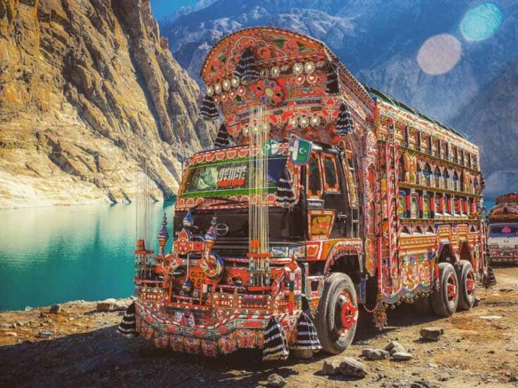
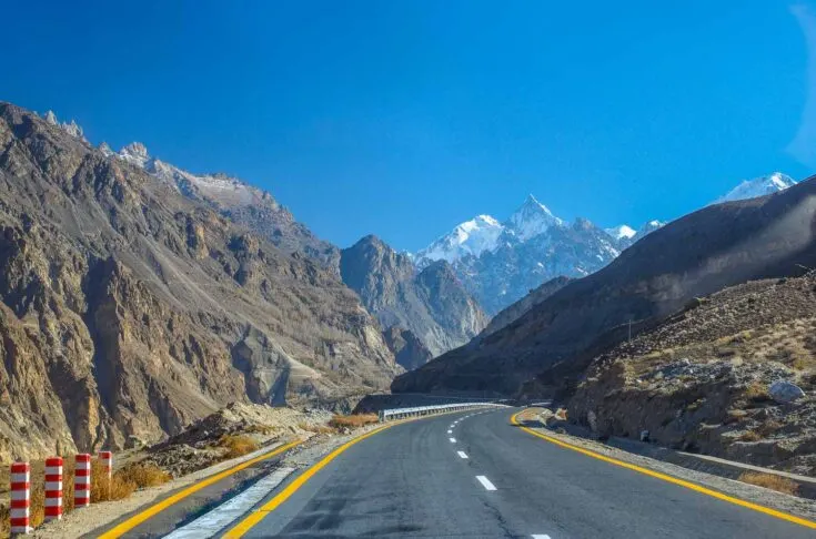
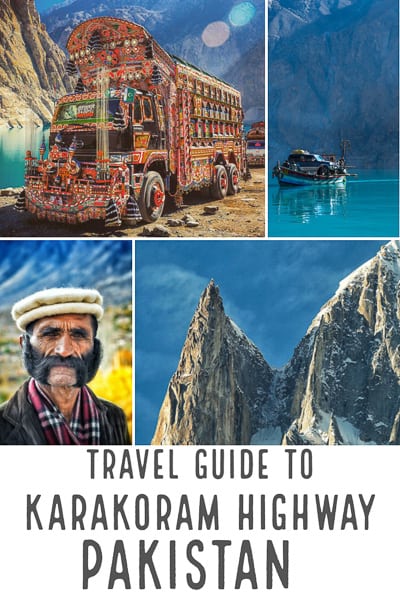
The Karakoram Highway, often just called KKH, is a highway that runs about 1,300km (800 miles) from Abbottabad in Pakistan to Kashgar in the province of Xinjiang in western China.
The Karakoram Highway was one of the greatest engineering achievements of the 20th century.

Today it’s the world’s highest international border at 4800m (1,600 feet) at Khunjerab Pass between Pakistan and China.
It is an unforgettable experience that will have you passing through surreal natural landscapes with the help of the eager locals.
In this guide, you’re going to discover everything you need to make the most out of your Karakoram highway tour. So, without further ado, let’s begin our journey!
The Karakoram Highway Starts From Abbottabad, Pakistan
The Karakoram tour officially starts from Abbottabad in Pakistan, a city that is famous for anything but the KKH in recent years.
You will, however, most likely start your vacation to Pakistan from Rawalpindi. Rawalpindi is located 14km south of the capital of Islamabad, the capital of Pakistan.
Important: All long-distance buses from the capital to around the country leave from Rawalpindi, not Islamabad itself.

Travel Tip: If you want to discover more of what Pakistan has to offer, check out this guide of Places To Visit In Pakistan.
KKH Road from Rawalpindi
The bus station in Rawalpindi is huge, chaotic, and dodgy. I got pulled aside by the security guards and hidden away in the backroom – for my own safety, they claimed.
That was fine for me since I had more than 4 hours to wait for the bus north after I arrived from Lahore.
I also was offered unlimited tea and food from the security guards while I was waiting for my bus north.
There are at least 2 “VIP” buses and a minibus leaving north a day, they all start from Rawalpindi around 16:00 and arrive in Gilgit around 18:00 the next day.
I made the mistake of taking the minibus. While it was comfy enough, the “VIP” buses were much faster and offered a lot more legroom.
It will be dark outside before you are out of the city, so you are not going to see anything before the next morning.
The first part of the journey is on proper tarmac, so it’s no problem to get some hours of sleep.
We stopped at least three times for toilet breaks during the night and once for food.
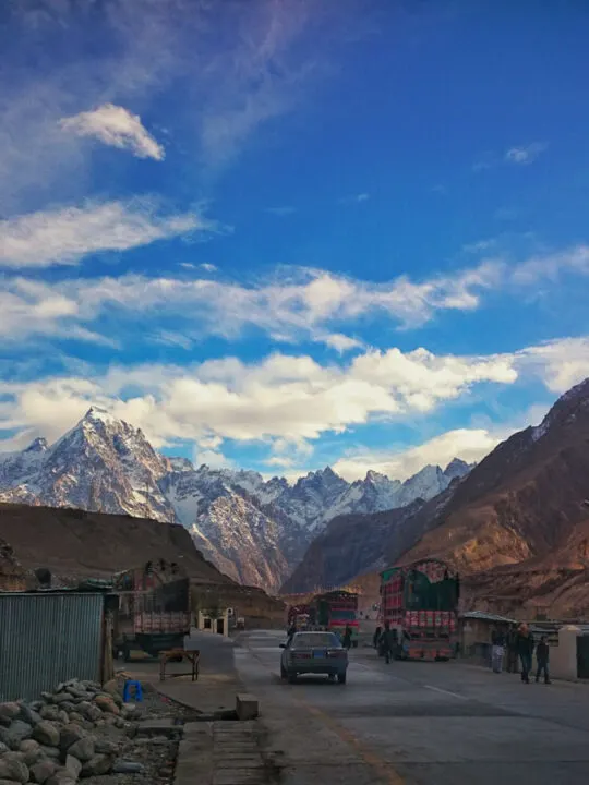
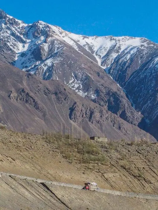
Somewhere along with the beginning of the Karakoram Highway. The place we stopped for breakfast not a bad morning view.
Unfortunately, it is pretty hard to take good photos through the window of the minibus, the roads are bumpy, and the windows are dirty.
So, instead of wasting battery, it is better just to enjoy the view.

There are a few military checkpoints on the way where you need to go out and register and provide them with a copy of your passport and visa. It’s really no hassle.
But then, at the checkpoint just before the town of Chillas, you will need to go through a proper security check. You will be taken to the side where portrait photos of you will be taken along with fingerprints.
You will then even get assigned a personal armed guard with an AK47 (strictly, no photos of my guard were allowed). The guard will accompany you on the bus for the next few hours.
It was just ridiculous. First, I was sitting anonymously in one of the backseats of the minibus and then got moved to the front seat next to the driver, together with my guard.
If there were any bad guys in the area, they could have easily have spotted me a mile away in the front seat.
The armed guard will accompany you to just before Gilgit.
Gilgit, KKH Pakistan
Gilgit is by far the biggest town in northern Pakistan, and you are guaranteed to stop by here for at least one night. It is also the transportation hub on the Karakoram Highway.
From Gilgit, you will have to arrange transportation to head east towards Skardu, west to Chitral, or north towards China.
The Karakoram Highway, often just called KKH, is a highway that runs about 1.300km (800 miles) from Abbottabad in Pakistan to Kashgar in the province of Xinjiang in western China.
Gilgit is also the ONLY place in Northern Pakistan with ATMs that work with western bank cards. But they were out of money while I was there – so it’s best to come prepared.

The town itself is not much to brag about. You will most likely arrive in Gilgit just after dark (I did), so it’s a good idea to have an idea of where you want to stay when you arrive.
The bus station is located on the southern edge of the town, and it’s a 10-minute taxi ride to the center of town where most guesthouses are.
I stayed in Medina Guest House, which is popular with travelers. A small double room with a squat toilet and cold shower was 300PKR – less than 3 USD.
Other accommodation options include:
Citi Hotel Gilgit
Naveed Tourist Inn
Riverdale Resort
There is no reason to spend much time in Gilgit; it’s better to move on to Skardu or Hunza Valley.
There is a jeep/minibus station where you can get transport to Hunza Valley. It is less than 10 minutes walk from where I stayed.
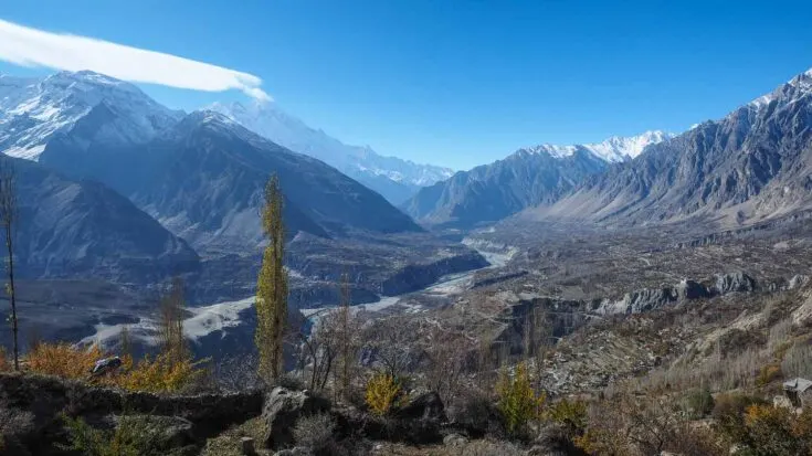
Hunza Valley Road Trip Pakistan

The road from Gilgit to Hunza Valley is nice and smooth, with great mountain views all the time.
The jeep will most likely drop you off in Aliabad, the main town in Hunza Valley, but this is not where you want to stay.
You’ll want to catch another jeep going to Karimabad. It’s another 15-20min drive, so it’s too far to walk.
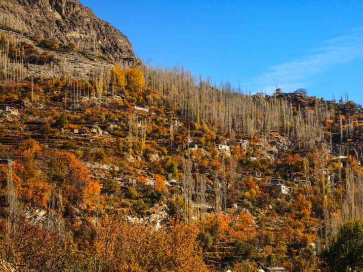
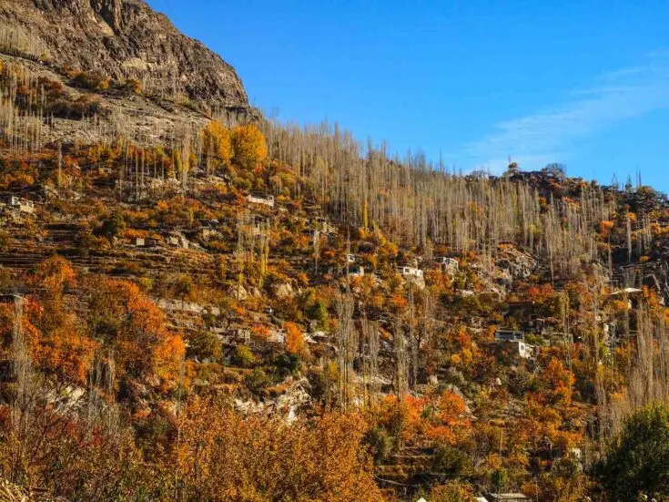
Karimabad is overlooking Aliabad and the whole valley and offers one of the best views in the world. Here you can easily understand why Hunza Valley is named the last Shangrila. I could happily retire and live here.

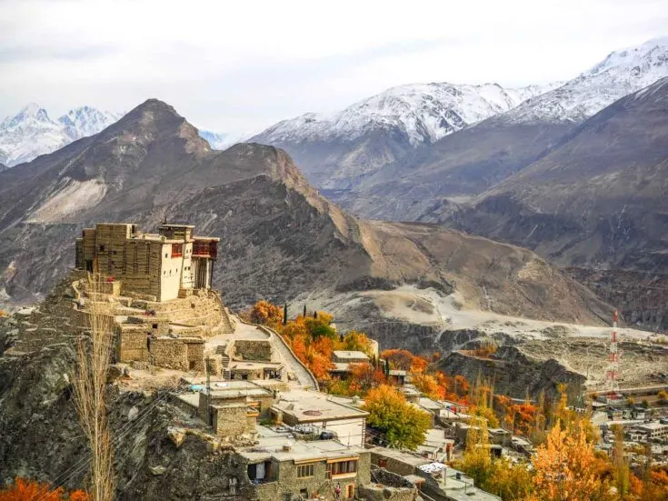
Karimabad is just amazing. It offers a 360-degree view of mountains, two Unesco Heritage sites, extremely friendly and welcoming people, and the best walnut cake anywhere in the world.
If you’re interested, they even make decent moonshine.

Things to Do in Hunza Valley

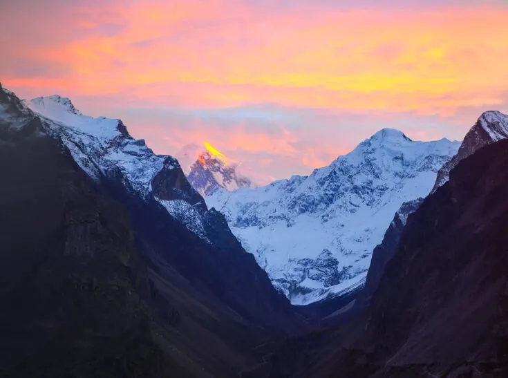
One of the best things to do in Hunza is to climb some of the hills surrounding the valley, meet the locals, and hike up to the Eagle Nest restaurant and hotel.

The Eagle Nest is located on a high hill overlooking the valley. The locals claim they can walk up there in less than 1 hour, but it took me almost 3 hours. It’s steep (very steep), but it offers a million-dollar view.

Attabad Lake Crossing
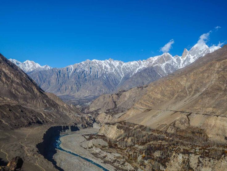
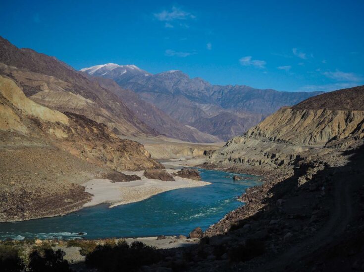
When you’re ready to leave “Shangrila” and continue your journey along the Karakoram Highway, the next stop is Attabad Lake. It is located just about one hour north of Karimabad.
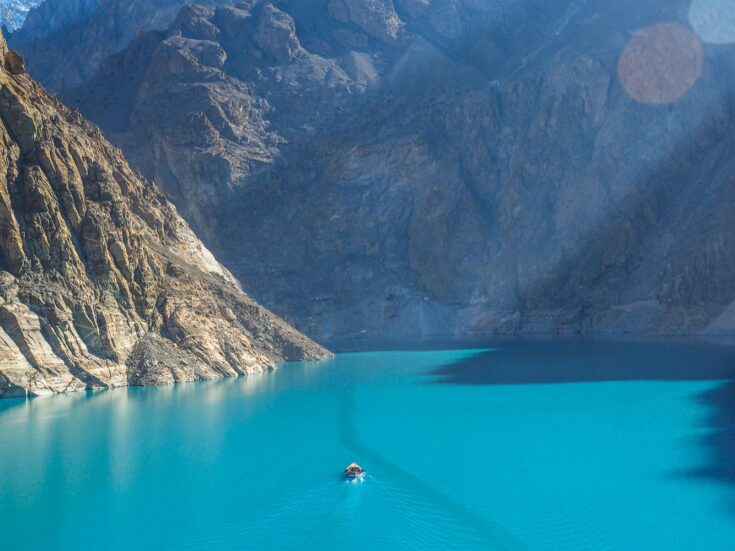

Attabad Lake was formed just back in 2010 when a massive landslide buried a 19 km (12 miles) stretch of the Karakoram Highway. About 6,000 people got displaced.


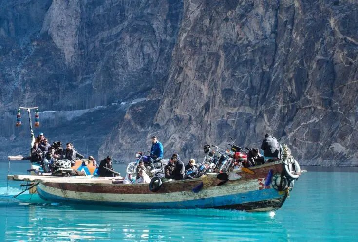
Today the lake is about 21 km (13 miles) long and more than 100 meters (330 feet) deep.
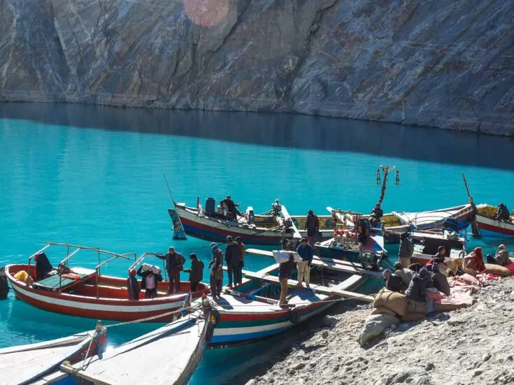
The only way to cross it is with small boats that shuttle across the lake – a unique part of the journey.
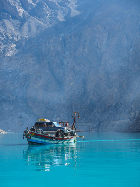
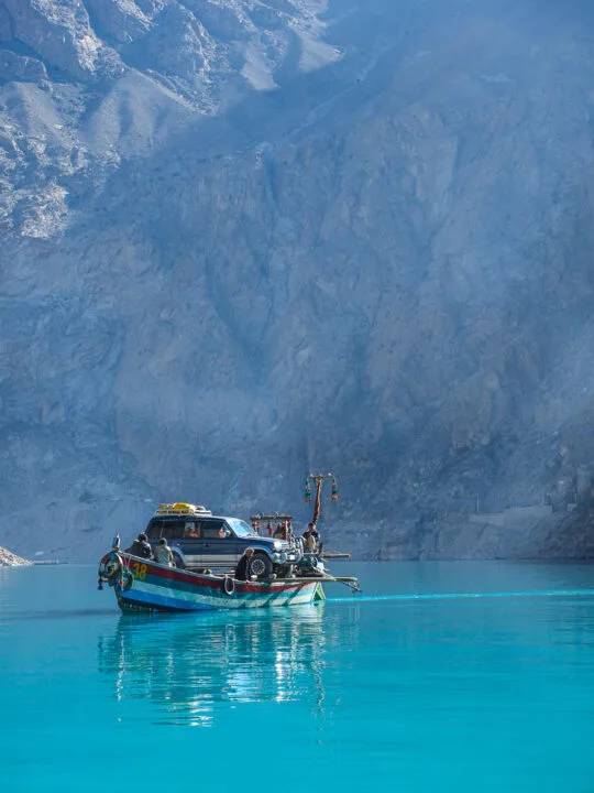
The ride across the lake takes about 40 minutes, and it’s absolutely freezing cold. Luckily the Chinese are blasting their way through the Karakoram mountain range these days, so you will not need to take the boat in the future while you travel along the Karakoram Highway.
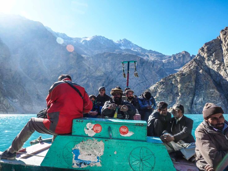
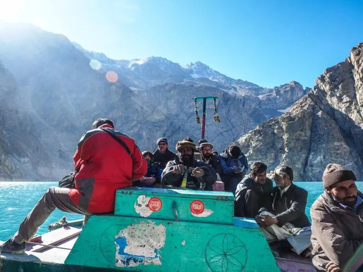
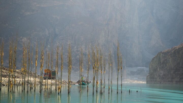
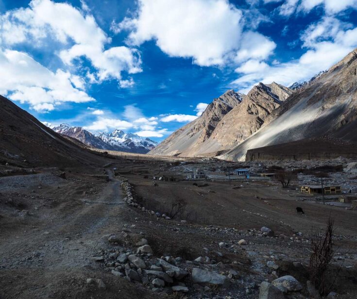
There are plenty of jeeps and minivans waiting on the other side of the lake, some go all the way to Sost, but the next obvious stop on the Karakoram Highway is the tiny village of Passu.

Last Stretch of the Pakistan Road Trip
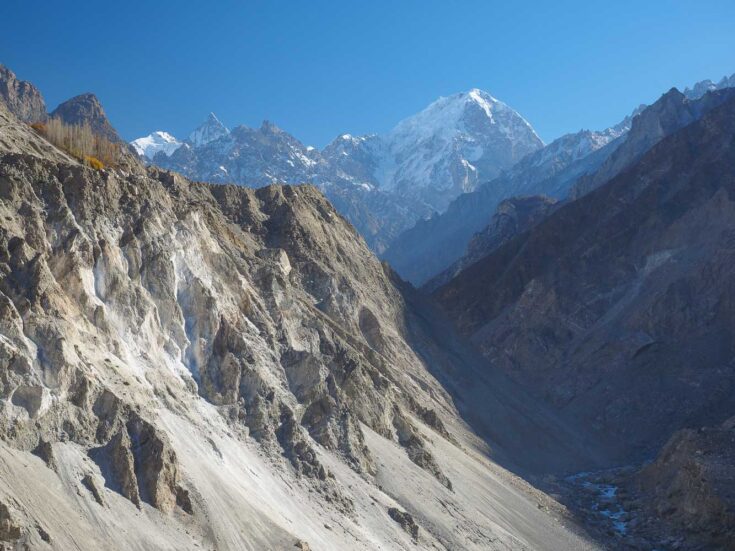
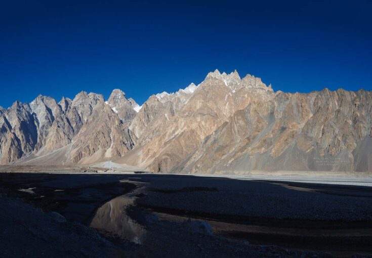
Passu offers world-class hiking around The Cathedral Ridge. I was, however, unfortunately there too late in the season, so all guides had ventured south for seasonal work in southern Pakistan.

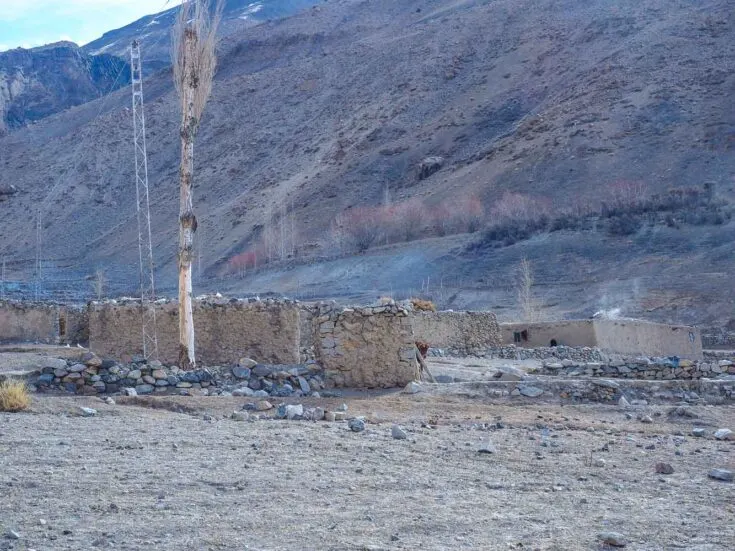
Passu has a few guesthouses, and the locals are very welcoming. I got invited for Chai (Tea) everywhere I walked in the village.
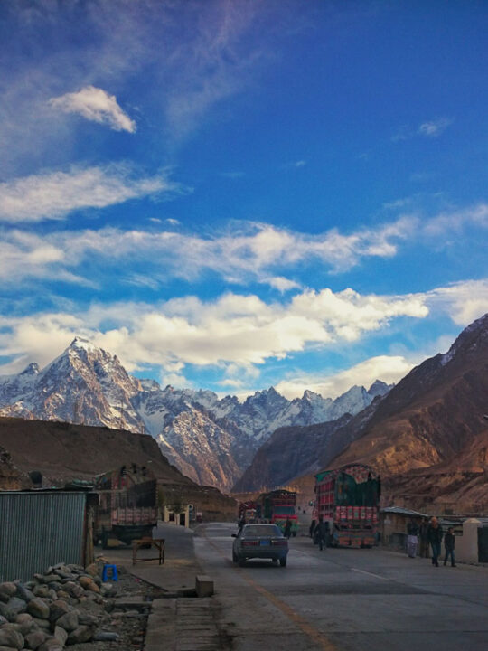
The next and last stop on the Karakoram Highway in Pakistan is the sleepy town, Sost.
Sost is a typical border town, with traders from both China and Pakistan.
Typical Chinese merchandise and even Tsingtao (Chinese beer) are easily available here.
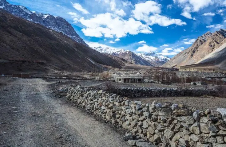
Chapursan Valley Side Trip
If you have some extra time on your visa and want to spend some extra days in Pakistan, you can do an easy side trip to Chapursan valley.
Chapursan valley is located less than 10 km (6 miles) from the Afghanistan border; it offers volunteer work and a homestay.

There is amazing hiking available around Chapursan valley, but I was running out of time, both on my visa and because the Pakistan/China border was closing down for the season.

The last village in the valley is Zood Khun. You can find a homestay run by the redoubtable Alam Jan Dario – horseman, musician, and ambassador of Wakhi Tajik culture.
He runs cultural and adventurous treks on foot or horseback into the valleys and over the passes of his spectacular homeland.

Chapursan valley is mentioned in the book “Stones into School”.
The book is the sequel to the award-winning book Three Cups of Tea by Greg Mortenson’s humanitarian efforts to build schools in Pakistan and Afghanistan.
You will actually stay in one of the houses and with the family of one of the main characters in the book.
Karakoram Highway: Pakistan to China
There is one daily bus from Sost to Tashkurgan in China. You will do all your customs and paperwork with Pakistani immigration in Sost, which will take a few hours.
Important: Make sure to have your yellow vaccination book ready; they will check that you have a Polio vaccination.

The road from Sost to the border goes through Khunjerab National Park. You will still have to pay the entrance ticket of 10 USD – even if you are just passing through on your way to China.
The border crossing between Pakistan and China is on Khunjerab Pass at 4,800m (1,600feet), officially the world’s highest border crossing.
Immigration and customs on the Pakistani side are straightforward and easy but very slow.
The Chinese side, on the other hand, is extremely strict.
I have crossed into China overland before from Kyrgyzstan, Kazakhstan, Russia, Mongolia, Laos, Vietnam, Hong Kong, and North Korea.
And the Pakistan – China border crossing is nothing like any of those.
You will have to empty all your luggage twice with sniffer dogs around, x-ray your luggage, and then customs will go through your camera and check EVERY SINGLE photo on both your camera and phone.
They will also go through your tablet/laptop, and they will do this for everyone on the bus.
It takes time, a lot of time. My bus was on the border for about 6 hours.
Since I was the only tourist on the bus, I was the first person they checked and let through.
They will not stamp your passport on the Pakistani – China border.
When everyone is done with immigration and back on the bus, two Chinese military guards will accompany the bus till it reaches the immigration point in Tashkurgan.
The bus will not stop between Khunjerab Pass and Tashkurgan. So, be prepared for no toilet break.
After about four hours, you will reach Tashkurgan. Here you will have to clear customs and immigration again.
You will start the day at Sost at about 9 am, and you will be done with Chinese immigration around 1 am the next day.
There is actually an International Youth hostel in Tashkurgan, but it’s far from the immigration house.
It’s better for you to follow most of the Pakistanis on the bus to a hotel that is called “Pakistani House” – it’s less than 10 minutes walk from immigration and offers a single room (wi-fi available) and the best hot shower you have had since Islamabad for 30 RMB.

Travel Tip If you want to continue your journey on the Chinese side, my Tashkurgan guide is the perfect place to start.
The Karakoram Highway, often just called KKH, is a highway that runs about 1.300km (800 miles) from Abbottabad in Pakistan to Kashgar in the province of Xinjiang in western China.
Additional Info About the Karakoram Highway Tour
Apart from all the Karakoram Highway major cities that you have learned about so far, here is some more information that is important to know before leaving.
Border closing Pakistan / China
The border closes down between 1 December to around 1 May every year. During this time, more or less everything from shops, guesthouses, and transportation shut down. Some times earlier, some times a bit later.
I did this trip from the 10th to the 30th of November, and most of the guesthouses started to close down around the 15th of November.
I met a few tourists that were traveling southbound up until 27 November, but I didn’t meet a single tourist that was traveling north towards China after the 20th of November.
Safety in Northern Pakistan
Northern Pakistan is extremely safe. It is even safer than most of Europe these days.
The locals are very welcoming and open-minded. I was invited for food, tea, and even the local moonshine everywhere I walked.
Money & Price
The only ATMs in northern Pakistan are in Gilgit, but they are often empty. You are better off bringing enough cash for southern Pakistan.
You can find money exchanges in both Karimabad and Sost.
Try to exchange your Pakistani Rupee into Chinese RMB in Sost – most shops can exchange your money.
The bus from Rawalpindi to Gilgit was 1,400 Rupees (8 USD) with a student discount.
Most guesthouses are 300 – 500 Rupee (2 USD) for your own room with a bathroom.
Activities
Northern Pakistan offers unlimited, world-class hiking and mountaineering.
The best place to find a local guide is in Karimabad, Skardu, or Passu.
Paragliding is also offered in Karimabad.
It is possible to teach English in some of the villages in the north. In fact, a few of the families who invited me in for a cup of tea and dinner wanted me to practice English with their kids – both with their daughters and sons.
KKH Highway Experience
The Karakoram Highway is, without a doubt, one of the most unique tours I’ve been on.
While you are definitely heading off the beaten track, the views and cultural experiences are straight out of a travel novel.
With China upgrading the route as part of their belt and road initiative, your experience might be a bit different to my own.
If you notice anything that is different from my time here, I’d love to hear about it in the comments section below. Have a safe trip!
Stanley
Friday 5th of January 2024
Hi Christian, Thank you very much for this useful blog. You wrote the border crossing will be closed till 1st May but some say they have changed and will open on 1st April, have you heard anything about it? Hope someone can reply.
Ahmed Bilal
Sunday 19th of April 2020
karakoram highway is one of the most adventure road trip in the world. i m Pakistani and i was visit last december . its too amazing... Thanks for sharing admin.
George C. Silides
Wednesday 10th of June 2020
My wife and I travelled on the Karakorum Highway, in September. October 1994, from Kahsgar to Rawalpindi, after crossing China, from the Head Of the Dragon to its tail, was out west, past the Tamaklatan desert. In 1994, the "Highway" was still being cut out of the mountain, following the Indus River. Land slides were frequent, and maintenance crews lived in ramshackle tents along the route. The scenery was as now. Stupendous. We visited Rakaposhi and Nanga Parbat Mounyains. Unforgetable.
We still have pictures from that trip, and my wife, Dot, prepared a travel log of the adventure. If you are interested in seeing them, let me know
Ririe
Sunday 26th of January 2020
Hello! I am heading to Pakistan in June, and this is the exact information I need. Is there any updates about the trip procedure, since this in 2020 now? And by polio vaccination, do you mean I should get it in my home country or I can do it in Islamabad or Lahore? Many thanks.
Christian L.
Monday 27th of January 2020
Hello Ririe. As far as I know, is the information here still up to date. You should get the Polio vaccination in your home country if possible.
The World's Most Dangerous Roads – Big 7 Travel
Saturday 5th of October 2019
[…] 7. Karakoram Highway – Pakistan and China […]
Aryaan Asad
Thursday 12th of September 2019
nice article